Home · Catalogue · Fore-Edge Paintings · S.I.6340
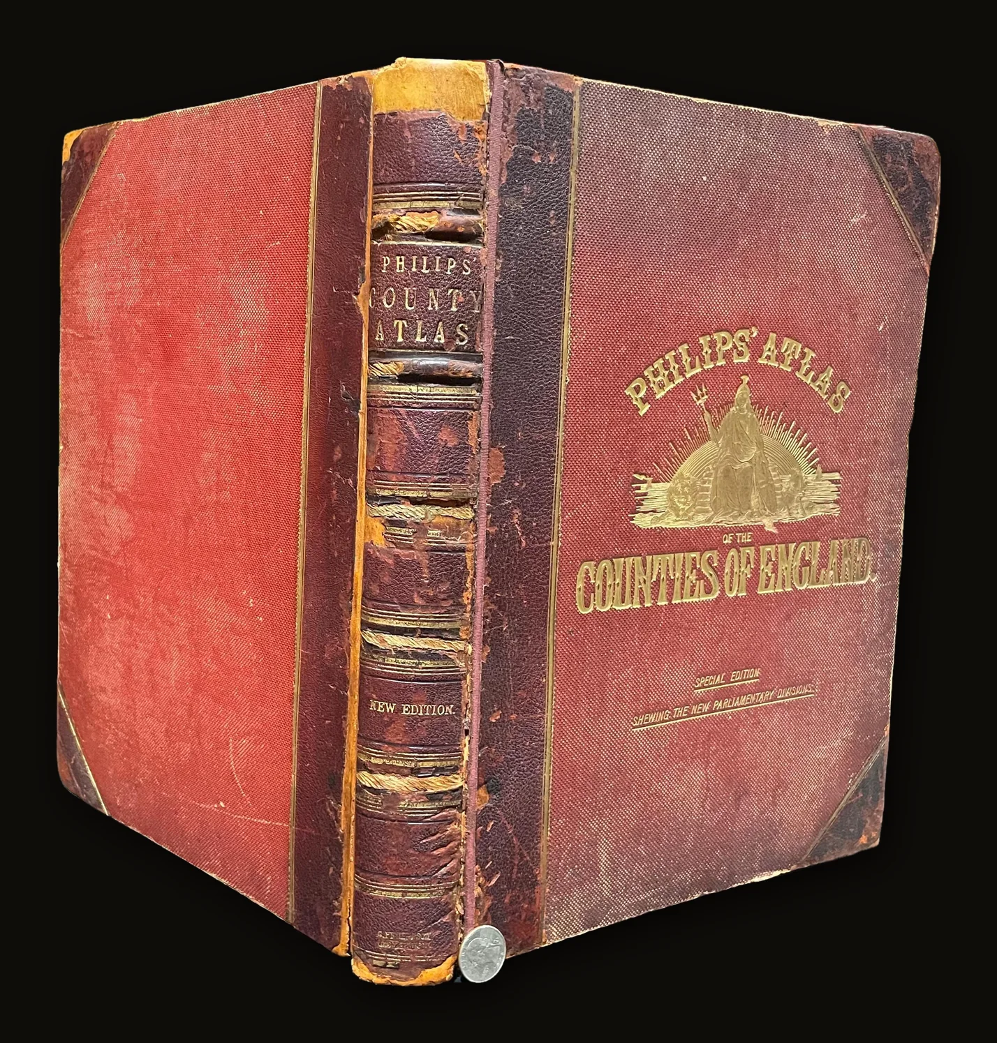
Philips' Atlas of The Counties of England, Including Maps of North & South Wales, The Channel Islands, and The Isle of Man. New and Revised Edition, With a Complete Consulting Index. Special Edition Shewing the New Parliamentary Divisions
Philips, George · London
- Author
- Philips, George
- Date
- c1868
- Place
- London
- Publisher
- George Philip & Son
- Language
- English
- Binding
- Folio. (10" x 14.5") half burgundy leather with corners, thick double gilt rule to leather edges, over red buckram, front cover with gilt title/info surrounding a gilt vignette of Columbia sitting in front of a rising sun. Rebacked spine with with five raised bands (2 partially remain), gilt author/title to second compartment, gilt edition to fifth compartment, thick gilt rule bordering all other compartments. 48 folding colored maps as called for with an additional map NOT called for, of the Whole of England, tipped in before the index. All edges gilt, marbled endpapers. Edgewear, corners replaced, rubbed with missing color, board edges scraped and bumped, head and foot of spine chipping, since replaced with loss of color. Fore-edge of first free endpaper chipped with tiny closed tears, small loss. Tape reinforced joints for stability. Several pages of index with paper repair to fore-edges and corners. Long closed tear with tape repair to 3 folding maps, additional England map with extensive tape repairing, lower right corner replaced. Much marginalia to the plates with most maps notated with symbols representing towns, etc. (see pic). This volume is complete in regard to contents, and contains an additional map tipped in before Index.
- Category
- Fore-Edge Paintings
- Record
- S.I.6340
Philips' Atlas of The Counties of England, Including Maps of North & South Wales, The Channel Islands, and The Isle of Man. New and Revised Edition, With a Complete Consulting Index. Special Edition Shewing the New Parliamentary Divisions
Author: Philips, George Folio. (10" x 14.5") c1868. Philips, George. London. George Philip & Son. Half burgundy leather with corners, thick double gilt rule to leather edges, over red buckram, front cover with gilt title/info surrounding a gilt vignette of Columbia sitting in front of a rising sun. Rebacked spine with five raised bands (2 partially remain), gilt author/title to second compartment, gilt edition to fifth compartment, thick gilt rule bordering all other compartments. 48 folding, colored maps as called for with an additional map NOT called for, of the Whole of England, tipped in before the index. All edges gilt, marbled endpapers. Edgewear, corners replaced, rubbed with missing color, board edges scraped and bumped, head and foot of spine chipping, since replaced with loss of color. Fore-edge of first free endpaper chipped with tiny, closed tears, small loss. Tape reinforced joints for stability. Several pages of index with paper repair to fore-edges and corners. Long closed tear with tape repair to 3 folding maps, additional England map with extensive tape repairing, lower right corner replaced. Many marginalia to the plates with most maps notated with symbols representing towns, etc. (see pic). This volume is complete in regard to contents, and contains an additional map tipped in before Index. From Wiki: George Philip (1800–1882) was a Scottish cartographer, map publisher and founder of the publishing house George Philip & Son Ltd. Philip used cartographers such as John Bartholomew the elder, August Petermann, and William Hughes to produce maps on copper plates. Philip then had these printed and hand-coloured by his women tinters. By the time he produced his county maps of 1862 he was using machine coloured maps produced on power-driven lithographic presses.[1] 'His maps ranged from the expensive Imperial Library Atlas (1864) to an atlas costing as little as 3d. and, although the bulk of his production was for the commercial, and particularly the educational market, he also produced important scientific maps, notably of North America, especially the Arctic and Pacific Northwest, and of the West Indies. The firm supplied atlases, geographical and history books, school textbooks, and an array of educational books and equipment. The company also produced textbooks for overseas countries, starting with an atlas for Australian schools in 1865 and for New Zealand in 1869. The demand from board schools, established after 1870, enabled further expansion in the market for general textbooks, school stationery, atlases and wall maps, etc Philip also employed many noted writers including the geographer and historian John Francon Williams who wrote, compiled and edited many books for the company from 1881 over a 20-year period.
We are currently putting all 5000+ titles online, but if there is a specific title you are looking for, please reach out to sidekerbookselleratgmail.com, we may just have it!
Free shipping via USPS for United State purchaser within the continental U.S., International shipping determined using USPS Priority Express, DHL, FedEx, or Parcel Monkey.
Sonny Ideker Bookseller is located within City Antiques in Historic Roswell, Georgia at 700 Holcomb Bridge Road, Roswell, GA. 30076. We would love to have you visit or email us at sidekerbookselleratgmail.com for specific wants or needs, thanks!
Find Us On: Facebook: https://www.facebook.com/p/Sonny-Ideker-Bookseller-Rare-Antiquarian-Leather-Vellum-Bound-Books-100068669041560/ YouTube: https://www.youtube.com/@SonnyIdekerBookseller/about Instagram: https://www.instagram.com/sonny_ideker_bookseller Flickr: https://flic.kr/ps/2v6pn4 Website: https://sonnyideker.weebly.com/ Antique Books, Old Leather Book, Old Vellum Book, Decorative Binding, Antiquarian Book, Vintage decorative, Ancient Leather, Rare Books, Decorative Books, Decorative Leather, Beautiful Decorative Book
Condition
Fair
Guaranteed authentic and as described · 7-day returns · free US shipping — our terms. Subject to prior sale.